 English
 Čeština
Město:
Praha 1
Místo:
Klášter minoritů Praha, Malá Štupartská 6
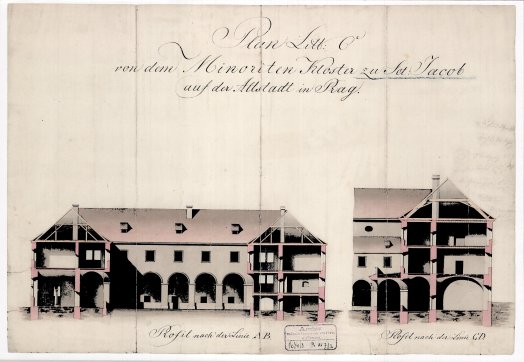
The exhibition Transformations of the Monastery in Maps presents a unique insight into the development of the building of the Minorite Monastery in Prague and its immediate surroundings between 1791 and 1912.
Through historical maps and plans, it illustrates the transformation of one of the most significant monastic complexes in the Czech lands, which in its time was the largest monastery in the country. Special attention is given to the extensive Minorite gardens that once stretched from Jakubská Street to Masná Street and formed an important part of Prague’s urban structure.
We were able to realize this vision thanks to cooperation with the Prague City Hall and the Department of Archives, who granted us access to valuable archival materials. Thanks to these sources, visitors can closely follow the changes of the monastery and its surroundings over more than a century.
Admission to the exhibition is included in the guided tour fee.